|
Innovative software gainings from the specialized in download catalogs! Investigate the popular software utilities sections, see the newest releases of the featured tools, and test directly! Do not fail an advantage to download the best software program: utilise SoftEmpire to download software solutions for free of charge. Meet the catalogue of free programs and software package versions. pick out among operating system utilities, get planners, antiviruses, and all other sorts of software apps for your notebook or mobile devices!
Multimedia software to view video, listen audio, view images. Video viewers, decoders and converters are available in our catalog. Video software for PC, iPhones and other mobile devices. Audio software helps you convert your favorite music and play on your favorite audio device like iPhone, MP3 flash player etc. Image viewers work fast and allow to convert in any image formats. Best multimedia software in our catalogue.
|
Canvas GIS Advanced (Mac)
|
|
Download
|
Buy now!
|

View screenshots
|
Vendor Price: $ 999.95
License: Shareware
File Size: 51.90 Mb
Version: 9.0.4
Release Date:
30 Apr 2004
OS: Mac PPC
System Requirements:
Mac OS X, 128 MB RAM 100 MB HD, 16-bit graphics, 1024 x 768 res
Company: ACD Systems
|
|
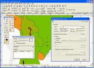
The CANVAS 9 Advanced GIS Mapping Edition adds native support for Geographic Information System (GIS) data to Canvas. You can take measurements in geographic coordinates, import industry standard SHAPE and GeoTIFF files into unlimited numbers of automatically aligned overlapping layers and choose among the following options:
?2, 104 Coordinate Reference Systems
?67 Operation Methods (like Mercator, Albers Conic Equal Area?)
?1, 052 Map Projections
?302 Geodetic Datums
?21 Angular units
?45 Length units
The CANVAS 9 Advanced GIS Mapping Edition bridges the gap between dedicated GIS analysis software and generic "DTP" software. For many applications CANVAS 9 Advanced GIS Mapping Edition can now replace programs costing thousands. For the rest, CANVAS 9 GIS Mapping Edition is now the preferred "last mile" publishing companion to dedicated GIS analysis software.Files Supported include:
oMapInfo oARC/INFO oUSGS Digital Line Graphs oTIGER(Census) oMrSID (Win. only) oGML (Geography Markup Language) oSDTS (USGS Spatial Data Transfer Standard) oGIS Text oGarmin (GPS) oECW (Enhanced Compressed Wavelet Images oS57 (IHO International Hydrographic Organization)
|
More to download:
010 Memorizer
010 Memorizer is a powerful program for memorizing numbers. The system works by converting a number into a word or phrase that creates a vivid image in your mind.
Atelier Web Ports Traffic Analyzer
Real-time mapping of ports to processes (applications and services), history and data logging since boot-time of all TCP, UDP and RAW ports open through Winsock.
WebLog Expert
WebLog Expert is a feature rich web server log analyzer. It will give you information about your site's visitors: activity statistics, file access statistics, paths through site, referring pages, search engines, browsers, operating systems, and more.
VB Image Map ActiveX Control
The VB Image Map OCX allows you to display interactive images in your applications. Hotspots within your image can be defined that will react to various mouse events. It uses standard HTML syntax to define hotspot coordinates.
European Geography Tutor
Want to brush up on the names and locations of the 40 or so countries of the new Europe? This program from the Family Games Web Center will help you. A study mode and two quiz modes make the learning easy.
PRIMARY LEARNING
PRIMARY LEARNING presents fifteen educational exercises for children aged 6 through 14. Numerous options allow for many variations in using the programs. BALLOON MAN features fun graphics and tests a child's spelling abilities in this Hangman-typ...
ViewGee
ViewGee the powerful and one-of-simplest image viewer and convertor available for Windows! ViewGee is two tools in one. A full-featured image viewer displays your images fast and easy. The image browser/converter lets you enchanced functions; for...
DWG to PDF Converter 2005.5
Any DWG to PDF Converter is a batch converter that allows you to convert DWG to PDF, DXF to PDF without the need of AutoCAD.
Easy CAD Solution Suite
Review CAD drawings in DWG, DXF, DWF format with a feature-rich viewer. Edit, modify design drawing and its internal objects attributes and properties. Convert between DWG, DXF, DWF, PDF, and various image formats without need for AutoCAD or Acrobat.
|
|
|
Windows Backup |
Looking for backup software? Try Handy Backup - automatic data backup to DVD, CD, FTP, network, or Online. Client-server enterprise backup software.
|
|
Top Downloads |
Sexy wallpaper changer & screensaver. New pics auto-downloaded every day!
Sexy 3D digital babes dance and strip naked in full screen virtual reality...
The Ultimate Goldfish Aquarium, featuring amazing and unique Goldfish
|
|

